编号:
CDUT-2023-43
标题:Global mining footprint mapped from high-resolution satellite imagery
入藏号:WOS:000975284100004
中国科学院文献情报中心期刊分区:环境科学与生态学2区(2022年)
本校作者:唐亮
来源出版物:Communications Earth & Environment 卷: 4 期: 1 文献号: 134
出版年:2023
第一地址:成都理工大学
代表图:
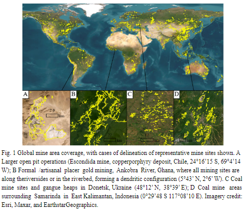
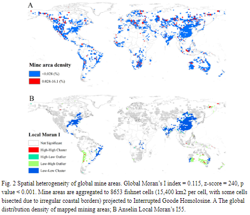
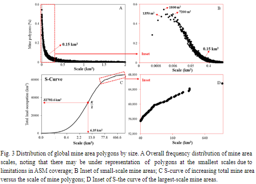
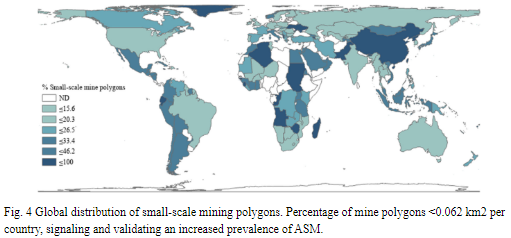
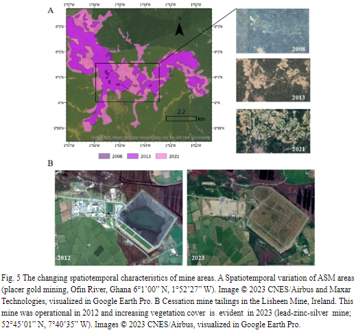
摘要:Mining is of major economic, environmental and societal consequence, yet knowledge and understanding of its global footprint is still limited. Here, we produce a global mining land use dataset via remote sensing analysis of high-resolution, publicly available satellite imagery. The dataset comprises 74,548 polygons, covering similar to 66,000 km(2) of features like waste rock dumps, pits, water ponds, tailings dams, heap leach pads and processing/milling infrastructure. Our polygons finely contour the edges of mine features and do not include the space between them. This distinguishes our dataset from others that employ broader definitions of mining lands. Hence, despite our database being the largest to date by number of polygons, comparisons show relatively lower global land use. Our database is made freely available to support future studies of global mining impacts. A series of spatial analyses are also presented that highlight global mine distribution patterns and broader environmental risks.
文章链接地址:https://www.nature.com/articles/s43247-023-00805-6