编号:CDUT-2024-24
标题:Change detection-based co-seismic landslide mapping through extended morphological profiles and ensemble strategy
入藏号:WOS:000782587700004
中国科学院文献情报中心期刊分区:工程技术1区TOP(2022)
本校作者: 王欣;范宣梅*;许强
* Corresponding author
来源出版物:ISPRS JOURNAL OF PHOTOGRAMMETRY AND REMOTE SENSING 卷: 187 页: 225-239
出版年:2022
第一地址: 成都理工大学
关键词:Co-seismic landslide mapping;Remote sensing;Change detection;Change vector analysis (CVA);Extended morphological profiles (EMPs);Multiple classifier ensemble
代表图:
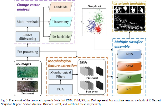
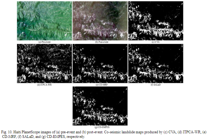
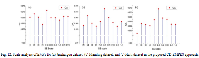
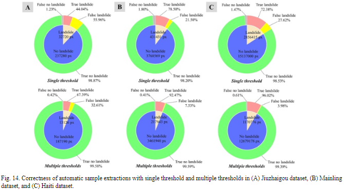
摘要:Co-seismic landslide mapping after earthquake event is essential for emergency rescue, geohazard prevention, and post-disaster reconstruction. Most co-seismic landslide mapping is primarily achieved via field surveys or visual interpretation of remote sensing images. However, such methods are highly labor-intensive and time-consuming, particularly over large areas. This paper proposed an automated co-seismic landslide mapping approach, which has three main advantages compared to state-of-the-art methods. First, it removes the dependence on the manual labeling for training samples through an unsupervised change detection process. Second, the approach takes the lead in introducing multi-scale extended morphological profiles to comprehensively describe the characteristics of various landslides induced by earthquake. Third, it is also the first attempt to employ ensemble strategy in landslide identification, which integrates the advantages of different machine learning-based classifiers, further improving the accuracy of recognition. Three experiments were carried out through multi-temporal Sentinel-2 and PlanetScope images acquired in China and Haiti. The results demonstrated the effectiveness and superiority of the proposed approach compared to other methods, providing an effective solution for complicated co-seismic landslide mapping task in the future.
文章链接地址: https://www.sciencedirect.com/science/article/pii/S0924271622000764?via%3Dihub#ab005