编号:CDUT-2023-65
标题:Hyperspectral imagery reveals large spatial variations of heavy metal content in agricultural soil-A case study of remote-sensing inversion based on Orbita Hyperspectral Satellites (OHS) imagery
入藏号:WOS:000918662000003
中国科学院文献情报中心期刊分区:环境科学与生态学1区/TOP(2022)
本校作者:戴晓爱;刘舒心; 项天羽; 付天章; 冯海鹏; 肖礼晓
来源出版物:JOURNAL OF CLEANER PRODUCTION 卷: 380 文献号: 134878
出版年:2022
第一地址: 成都理工大学
关键词:Heavy metal contamination;Hyperspectral imagery;Remote sensing;Orbita hyperspectral satellites (OHS)
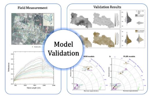
代表图:
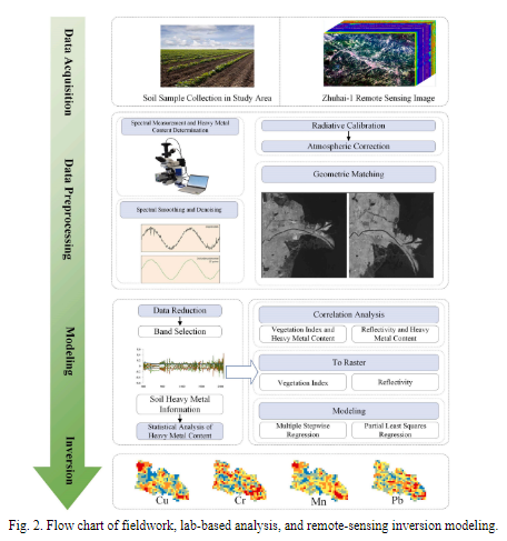
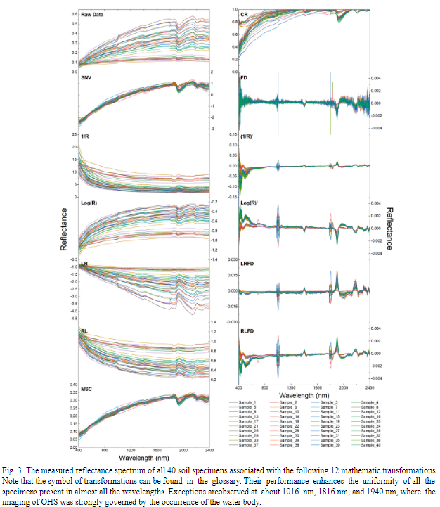
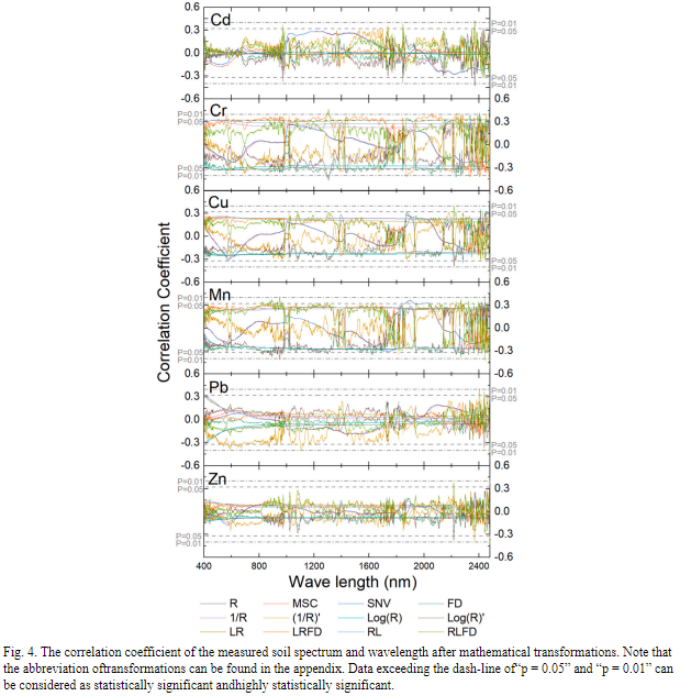
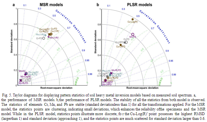
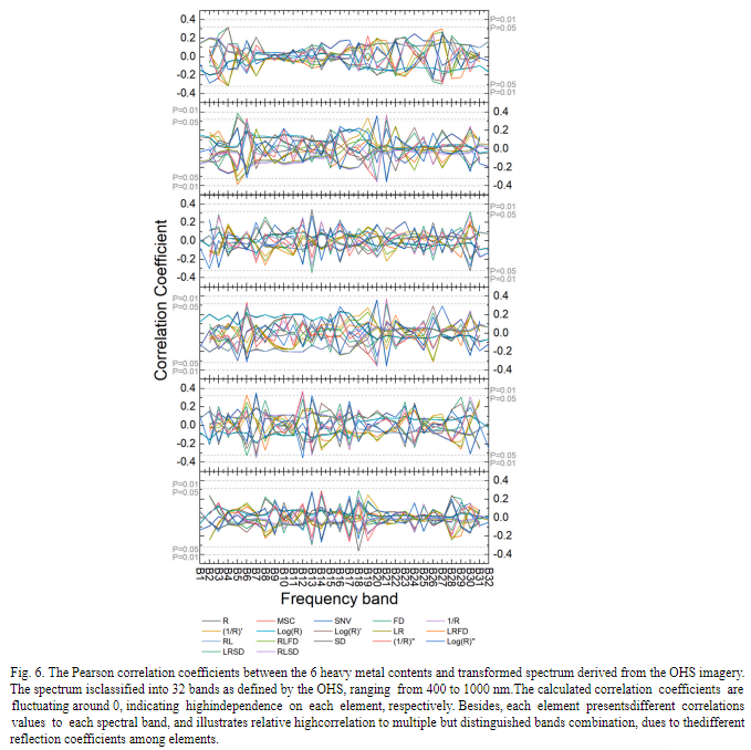
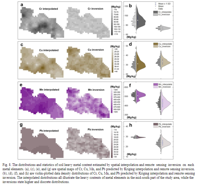
摘要:The widespread heavy metal contamination in soil induced by extensive human disturbance has been a global significant issue because of its chronic toxic effects on human health. However, the establishment of effective monitoring and assessing methods for heavy metal content in the soil remain a long-term challenge due to the intrinsic limitation of the current multi-band remote sensing technology and field measurement methods. Prompted by this significant technique gap, we represent an implementation of remote-sensing inversion models based on hyperspectral imagery to reconstruct soil heavy metal contents within an experimental farmland located in Mianzhu city, Sichuan, China. We collected soil samples at the pre-defined sites, and measured soil heavy metal contents and soil spectrum in the laboratory condition. Meanwhile, we obtained Orbita Hyper -spectral Satellites (OHS) imagery and quantified the associated vegetation indexes. The measured soil spectrum, bands of OHS, and the generated vegetation indexes were mathematically transformed to better represent their relations with soil heavy metal contents. Consequently, the most sensitive variables were selected as potent predictors of soil heavy metal contents in the inversion models. After evaluating the optimal inversion models for each heavy metal element, we implemented them to reconstruct the spatial patterns of soil heavy metal contents over the study landscape. We found obvious benefits of the remote sensing inversion model in predicting the spatial heterogeneity of heavy metal content within this small landscape patch. Specifically, the inversion model unraveled a normal distribution of heavy metal contents within the landscape, while the traditional spatial interpolation based on field measurements may suggest a largely skewed distribution. Compared with airborne -based studies, this study represents an application of spaceborne satellite data, which can be easily applied to a large spatial scale and long-term monitoring.
文章链接地址: https://www.sciencedirect.com/science/article/pii/S0959652622044511?via%3Dihub