编号:CDUT-2022-32
标题:Study of unpaved road surface erosion based on terrestrial laser scanning
入藏号:WOS:000608022600011
中国科学院文献情报中心期刊分区:农林科学1区/TOP
本校作者: 曹龙熹
来源出版物:CATENA 卷: 199 文献号: 105091
出版年:2021
第一地址: 成都理工大学
关键词:Unpaved road ;Road erosion ;Terrestrial laser scanning (TLS) ;Rill erosion;Red soil region
代表图:
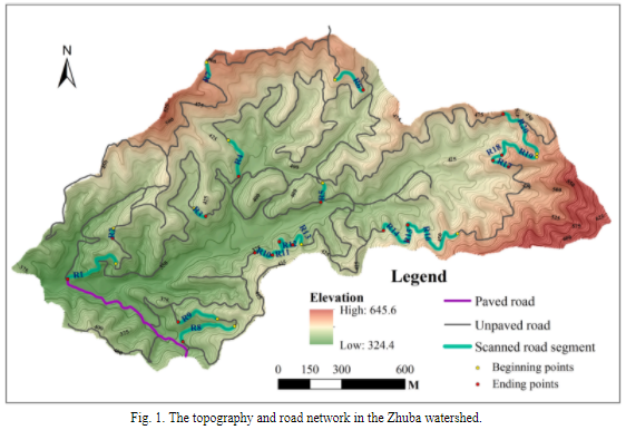
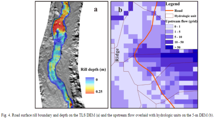
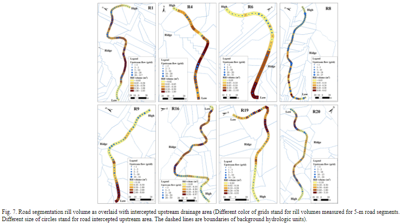
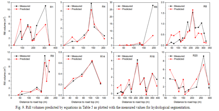
摘要:Road-related soil erosion is an important source of sediment that should be properly evaluated. Terrestrial laser scanning (TLS) can quickly acquire field soil erosion information and was adopted in this study to explore the details of soil loss along road segments. Twenty typical unpaved road segments in a small watershed of Southeast China were measured. High-resolution (0.05 m) digital elevation models (DEMs) were generated, and GIS methods were used to calculate the rill volumes and influential factors. The results showed that the studied unpaved roads were experiencing intensive erosion problems. The total soil losses from road segments were significantly related to the segment length, gradient and intercepted upstream flow area (Pearson R = 0.671, 0.579 and 0.747, respectively). A linear function (V = 0.205LS + 15.804A-0.626) composed of the above three factors was developed to estimate road segment soil losses. The detailed soil losses, which were measured in 5-m intervals along the road segment, generally increased with flow distance and reached peak value in the lower part of the road segment where a concave profile was found. Rill volumes along roads were closely related to the W/D ratio (rill width divided by depth) and slope gradient. A power function of gradient and distance to road segment top could be developed to predict locations with high erosion risk along roads based on the 5-m road segmentation. A high correlation was found between rill volume and the intercepted upstream flow area as calculated according to the background drainage divides. The predicting functions and a comprehensive model (V = 0.362S1.661L1.420UAh0.078) developed based on hydrological segmentation could simulate the rill volumes along roads and fit the peak soil losses very well. The above results can be helpful in guiding road erosion evaluation and conservation treatments.
文章链接地址:https://www.sciencedirect.com/science/article/pii/S034181622030641X?via%3Dihub